It was a good early climb out of the town and you were soon heading down the Llamberis path but on the western side.

It was here that we made the best mistake of the walk and I got confused between the words for the route and the map and we took a left turn down the valley. Ultimately we missed out on the Moel Eilio ridge walk but with all the walking ahead of us this shaved odd a couple of hours and was probably the best move that allowed us to enjoy the walk more.

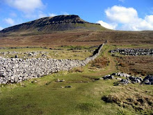
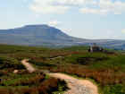
We walked at a reasonable pace all down the valley and it gave you a great perspective. As we popped out at the end of the valley you could see Snowdon ahead. However before that we had to tackle the grassy slopes of Moel Cynghorion that with its shear cliffs stood out as a high promontory in the valley.

From here we could see the ranger patch streaking up to the top but the really annoying bit was that we had to descend 500 feet really quickly before we started. The grassy slope down was probably the trickiest part of the climb.


Once on the Ranger Path it was proper walking and we pushed on upwards. I was always at or near to the back of the pack but kept up better than expected.


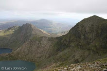
We cut across steep rocky and scree slopes on top of a dramatically steep ridge that you only really appreciated when you looked back on the way down.


The last push to the summit and my legs were feeling it. The summit was a little in cloud and the temperature a good 5 degrees colder and the wind twice a strong. With coats on we made the summit in good time and took the obligatory photo on top. Although the cairn was covered with bodies and it felt like town centre rush hour!


We stayed on the summit for a while taking photos for people and re-hydrating. After about 10 minutes the clouds lifted and we had fantastic views all around.


With plenty of time left we decided against the Pyg Track and bus and and headed down the Llanberis Pass. It was heaving with people and a loud bunch of kids so we walked close to the railway for a while before joining the path.


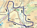
A well earned pint in the victoria hotel garden and we had been on the mountain for over 6 hours and 11 hours a magic walk! You can see the route on google maps at http://maps.google.com/?q=http://share.abvio.com/0487/b8ab/4cce/4a89/Cyclemeter-Hike-20101106-0831.kml
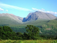
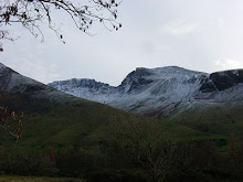
The following day we thought we would finish off the Moel Eilio ridge but when we looked out and the hills were white with snow, we took a low level walk around Ogwen Cottage and took some photo's of the stunning scenery.